


Floodlines app for iPhone and iPad
Developer: State Library of Queensland
First release : 29 Mar 2012
App size: 38.81 Mb
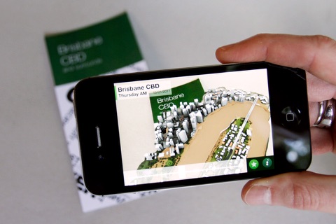
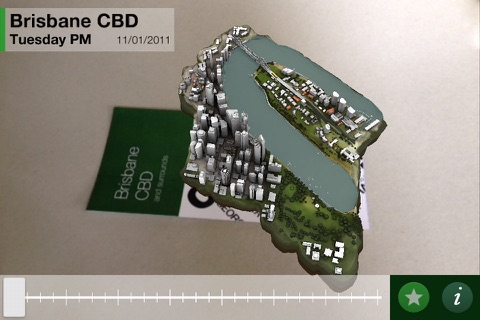
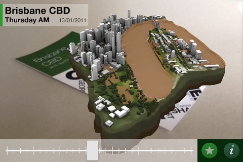
Floodlines App, for iPhone and iPad, uses extensive flood map data to provide you with new 3D perspectives of the Brisbane River, surrounding suburbs and rising waters during the devastating Queensland floods of 2010/11.
Using cutting edge augmented reality technology this App allows you to see the flood waters rise from 2D to new 3D aerial perspectives and simulate the flooding across the Brisbane CBD and surrounding areas. The app extends exhibition visitors understanding of the power of technology to visualise and share information.
Designed for use on Augmented Reflections feature within the Floodlines exhibition at State Library of Queensland.
Features include:
• Transforms 2D images into 3D views of the rising flood waters
• Allows you to simulate flood waters across Brisbane CBD and surrounding suburbs
• Kids scavenger hunt to locate items within the flood
• At home, use the App with maps collected from the Floodlines exhibition or download from the State Library of Queensland Floodlines website
Floodlines Exhibition
A living memory
7 April – 19 August 2012
Website: http://www.slq.qld.gov.au/whats-on